The Greater Accra Regional Security Council (REGSEC) has lifted the ban restricting access to the Borteyman enclave and adjoining lands with immediate effect.
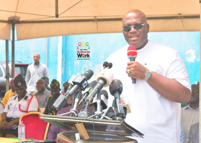
The Minister of the Interior, Henry Quartey announced this when a composite plan of the area was presented to him by the Lands Commission at a meeting held at the Greater Accra Regional Coordinating Council (RCC).
He said, “We have formally lifted the security ban restricting access to the Borteyman enclave and its adjoining lands. Therefore, land and property owners within the enclave are free to access their properties.”
In February 2016, the REGSEC chaired by the then Regional Minister declared Borteyman and some areas a security zone after gathering intelligence about imminent clashes between Top Kings and Empire Builders, who were engaged in a dispute over the land for decades.
Present at the meeting were representatives of the Nungua stool lands, some officials of the Lands Commission, members of the Greater Accra Regional Coordinating Council and staff of the Nungua Traditional Council.
The minister said following deliberations at its meeting held on February 8, 2024, REGSEC agreed for the Lands Commission to present the status of affairs and demarcation of boundaries after a court judgment on the ownership of the land.
The Survey and Mapping Division of the Lands Commission undertook the demarcation exercise to understand the subject matter of the court judgment.
He said the boundaries include 465 acres, 114 acres and 62 acres, all referred to in the court judgments.
Maxwell Adu Nsafoah, Technical Director of Lands, Ministry of Lands and Natural Resources and Head of Operations, Lands Commission said the RCC and Ministry of Lands directed the Lands Commission to demarcate the boundaries in the Supreme Court judgment in the said case.
According to him, a report on the demarcation of the land has been done and submitted to the Minister for Lands and Natural Resources for further action.
Robert Hackman Antwi, Chief Examiner, Survey and Mapping Division at the Lands Commission, who displayed the composite plan, said the 114 acres was later demarcated to be 114.33 while the 62. 01 acres was 62.04, showing all the parcel of land against the site plans used.
Oblantai Mantse of the Nungua Traditional Area, Nii Bortey Okplen Djalesane II, who was accompanied by other chiefs representing the Nungua Traditional Council, expressed satisfaction with the level of work done by the Lands Commission and the Ministry of Lands while thanking REGSEC for their role in the exercise and the challenges the stool has faced in addressing this land dispute for 23 years.
ALSO READ:


![REGSEC demolishes illegal structures on Weija, Dansoman Ramsar sites [Video]](https://www.adomonline.com/wp-content/uploads/2025/04/WhatsApp-Image-2025-04-10-at-13.18.49-218x150.jpeg)
![REGSEC demolishes unauthorised structures in Dodowa forest [Photos] REGSEC demolishes unauthorised structures in Dodowa forest](https://www.adomonline.com/wp-content/uploads/2024/08/Capture1-750x375-Copy-218x150.jpg)


